
The mountains of Western North Carolina hold many secrets. By nature, the cragged peaks and deep valleys of the ancient mountain range are difficult to crack. Forgotten history exists down every holler and those lucky enough to discover it are left to remember and retell the stories given to them.
Down the Gorge to Lost Cove
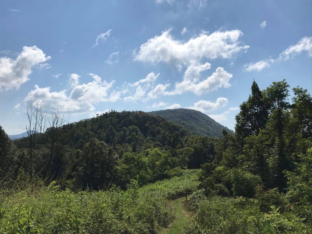
The trail head can be found here. It’s about noon when my brother and I set off up the hill toward the summit of Flat Top Mountain, north of Burnsville, North Carolina. The trail guide I have pulled up on my phone says the first part of the trail gains 100 feet of elevation in the first 400 feet and the trail looks every bit that steep. By the time we break out of the trees into Joe Lewis Field, the both of us are too winded to care who Joe Lewis is or why he has a field. With a brief stop to catch our breaths, it becomes clear we’ve stumbled onto a place where few people have been. Aside from the mowed path up the hill, the meadow is covered in brambles and grasses almost 6 feet tall and is a veritable butterfly garden. Blue and black swallowtails flit from thistle to thistle and the sound of bees buzzing is loud enough to make us wonder whether there wasn’t a swarm just out of sight.
It’s another trek to the top of the hill, where the full glory of the meadow is laid out below us. The trail comes to a T and we turn left towards the entrance to the cove. The trail snakes along the ridge line, descending slowly for about 500 feet or so. At the tree line, we pass the trailhead marker for Lost Cove, a 4 foot tall, green plastic marker bearing the trail rating: most difficult. Sure enough, we’re soon headed down switchbacks, descending down the steep side of Flat Top Mountain into the Poplar Gorge of the Nolichucky River.
Clambering over moss-covered boulders, through large ferns and tall hardwood forests for a little over a mile, we eventually come to another fork in the trail, where a barely visible path leads adventurous hikers off to a further point on the other side of Lost Cove. We continue down the hill, over a small stream, and past a spring dripping out from a crack in the rocks. Near the bottom of the cove, the trail comes to another T, heading right down the mountain and left into a thicket.
Walking into Lost Cove

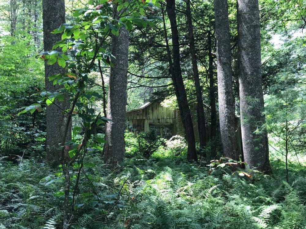
The first building of Lost Cove appears suddenly out of the woods, a dilapidated 2 room house with a wrap-around awning held up by logs from the surrounding area. A large fire pit and a long log are set up for camping and there are signs of life everywhere: plastic and a few beer cans dot the grassy areas surrounding the house. Further down the trail stand a set of concrete steps, all that remains of the church that once stood in Lost Cove. Strewn around are remnants of a tin roof and old gas cans. Through the trees, you can see the other full house still standing in Lost Cove. Through the years, the mountains have all but reclaimed that home. It is so buried by vegetation that one would need to be looking for it or would risk missing it.
Lost Cove was once a bustling logging town. Founded around the time of the Civil War, legend has it that the first settlers of Lost Cove were members of Daniel Boone’s party that never left. The town was connected to the outside world only by footpaths originally and was, for much of its existence, a self-sufficient town. When the logging industry came calling in the early 1890s, it brought with it the Carolina, Clinchfield, and Ohio Railroad, reliably connecting Lost Cove to the outside world for the first time. With the loggers came prosperity and a happy life. But by 1905, resources were drying up, the trains quit stopping in Lost Cove, and families began to leave the settlement. The town was finally abandoned in 1957.
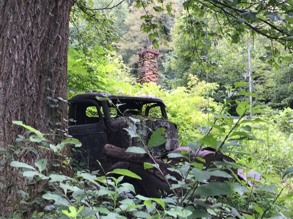
My brother and I follow the trail several hundred feet farther until it disappears into the thicket before turning back toward the top of the hill. After a quick lunch at the campsite, we head down the other branch of the trail. We come up on a lone chimney standing in a thicket of oak and maple, several house foundations, stone walls, and even a ruined 1930s-era pick up truck.
The Trek Out of Lost Cove
The hike back up the side of Poplar Gorge is brutal. Be prepared for a climb. The town is absolutely worthy of the hike, but getting back up to Flat Top mountain is no joke. You will climb about 2500 feet in about 3.5 miles with an average trail grade about 5-7%. It took us about 2 hours, including time for copious rest stops and water breaks. For more details on the hike to and from the settlement, check out this article by a local blogger.
